The speaking series curriculum in detail. The curriculum is divided into seven content areas, outlined below. Talks, guest lectures, discussions, and informal chats can touch briefly on aspects of multiple content areas, or can be tailored to focus on one particular content area. I have included a handful of references that cite key details and provide additional context.
A slideshow consisting of historical and contemporary maps also illustrates some themes outlined in these content areas.
1. Presence and Absence, Life and Death, and the Religious Freedom Restoration Act.
The role of spirituality and the application of the Religious Freedom Restoration Act (RFRA) in the trials, particularly in the misdemeanor trials. The history of RFRA and its application in other immigration and border contexts. Challenges to using RFRA in the trials. The support of religious and spiritual leaders during the trials. Search, rescue, and recovery of human remains in the Growler Valley. Water as humanitarian aid for the living, and as memorial to those who died. Items left behind in the desert as artifact, trash, and sacred objects. A RFRA defense was also used by land and water protectors at Quitobaquito during border wall protests.
See Elizabeth Reiner Platt (2025), “Religious Liberty and Immigration: Legal Analysis of Past and Future Claims,” a Law, Rights, and Religion Project publication at lawrightsreligion.org.
2. The “Co-Evolution of Militarization and Conservation” in the Desert, and A New Land Tenure Regime for the Border.
It was land management agencies that enforced certain misdemeanor laws against humanitarian aid workers and land defenders. An historical geography of how the region’s system of land tenure and current land use boundaries came to be. The “coevolution of conservation and militarization” (Lisa Meierotto’s phrase) in the desert. What was the land tenure regime in this borderland region before? A new multiple use framework that has emerged for border federal lands, and the consequences of this new framework to people, land, water, and wildlife.
See Lisa Meierotto, Immigration, Environment, and Security on the U.S.-Mexico Border (Palgrave McMillan, 2019).
3. Experiencing the Border “State of Exception” First Hand.
Giorgio Agamben’s concept of the “state of exception” provides a helpful framework for understanding the border humanitarian aid trials. The back and forth between prosecution and defense on necessity, targeting, surveillance, search, seizure, and the Fourth and First Amendments. No More Death’s disappeared report documented destruction of humanitarian aid by Border Patrol. A Border Patrol and prosecution conspiracy narrative that included everyone. Moving through border patrol detention as a “U.S.C.” (U.S. Citizen). Navigating pretrial restrictions. Checkpoints. A new perspective on the place emerged from this experience. Master narratives about the border and immigration have shifted dramatically in the years since.
See Giorgio Agamben, State of Exception, translated by Kevin Attell (University of Chicago Press, 2005).
4. A Relational Field of Border Humanitarian Aid.
A history of humanitarian aid and activism in Ajo and how this history relates to other border places. Past legal challenges to humanitarian aid, including littering and transporting charges. A variety of organizational and individual approaches to humanitarian aid today. An opportunity to work with interpersonal conflict. Volunteers, coordinators, bottom liners, and leaders in the trial. An encounter with media. The tendency to make people into characters and to create narratives. A personal experience of becoming a “research subject.” An encounter with ego. Positionality, intersectionality, privilege, and institutional harm in the courtroom. A public campaign to “drop the charges.” Asylum support, protecting communities, and humanitarian aid work all continued during the trials.
See Emily (Evan) Saunders and Max Granger (2019), “The Trials of Scott Warren,” The Baffler, 5 December, at thebaffler.com.
5. A History of “Harboring.”
A history of so-called harboring laws and their parallel evolution alongside immigration laws. The centrality of the Bracero program and mass deportation era politics of the 1950s in shaping the modern harboring law. Formal and informal exceptions to the law for employers and religious organizations. The ambiguity of the harboring law, its uneven application, and its different interpretation across U.S. federal court districts. A potential defense against harboring may exist through the Religious Freedom Restoration Act.
See Hannah M. Hamley (2020), “The Weaponization of the Alien Harboring Statute in a New Era of Racial Animus,” In Seattle Law Review, Vol. 144, pp. 171-204.
6. From Copper Mining to Border Security, and a New Kind of Company Town.
Before the modern border security regime, the copper mining industry dominated the social relations of the Arizona-Sonora borderland. Similarities exist between the company towns of the copper mining era in the 20th century and the border security era of the 21st century. It can be helpful to think of border security today as being like an extractive industry. And it can be helpful to think of many aspects of border-wall building today as being like a public-private infrastructure project (Sarah Jo Peterson’s observation). Surveillance and censorship was widespread during the company town era, and so too in the border security era. Local people have resisted, accommodated, and participated in both industries.
See Sarah Jo Peterson, Planning the Home Front: Building Bombers and Communities at Willow Run (University of Chicago Press, 2013).
7. A Strong Defense, and then Becoming Educators.
A look at how the defense team’s arguments and approach changed over the course of two felony harboring trials. Reasons for a hung jury in the first trial. Potent advice from a jury consultant in the second trial. Putting up a strong defense against the prosecution’s arguments, but becoming educators in the second trial (a point made by astute trial observers). The support of professors and educators broadly. Geographical insights on the key concepts of orientation and landscape in the second trial. A border patrol way of seeing is revealed. A critical 90 seconds before the 4th amendment applied. From the provision of medical care in the first trial, to simply caring about people in the second trial.
See Don Meinig, “The Beholding Eye: Ten Versions on the Same Scene, in The Interpretation of Ordinary Landscapes (Oxford University Press, 1979: 32-48).
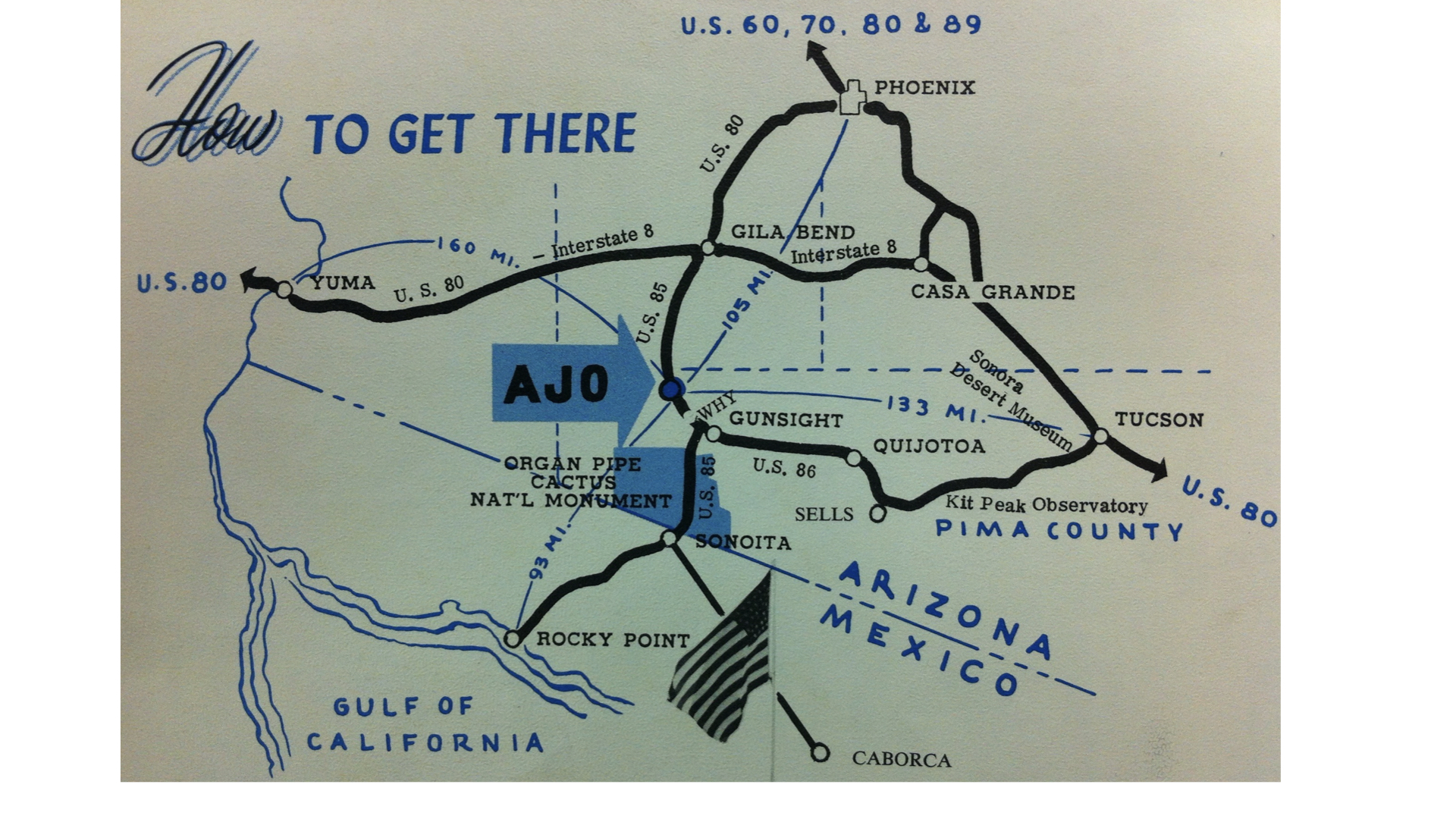
How to Get to Ajo. In “Where Summer Spends the Winter,” Ajo Chamber of Commerce Promotional Material, 1960s. 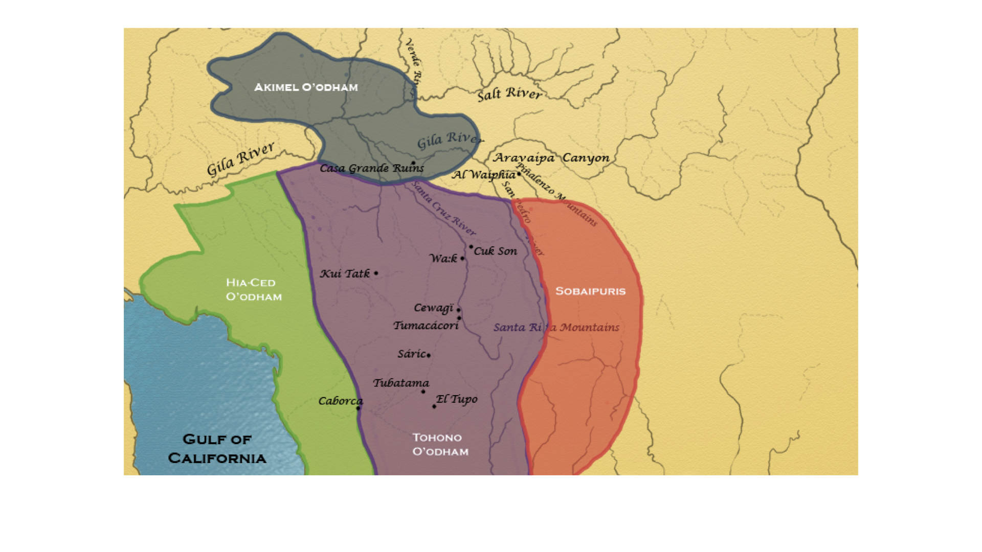
Indigenous O’odham Lands. Map from Karl Jacoby (2008), Shadows At Dawn, under Creative Commons License at webhelper.brown.edu/giovi/Aravaipa/ 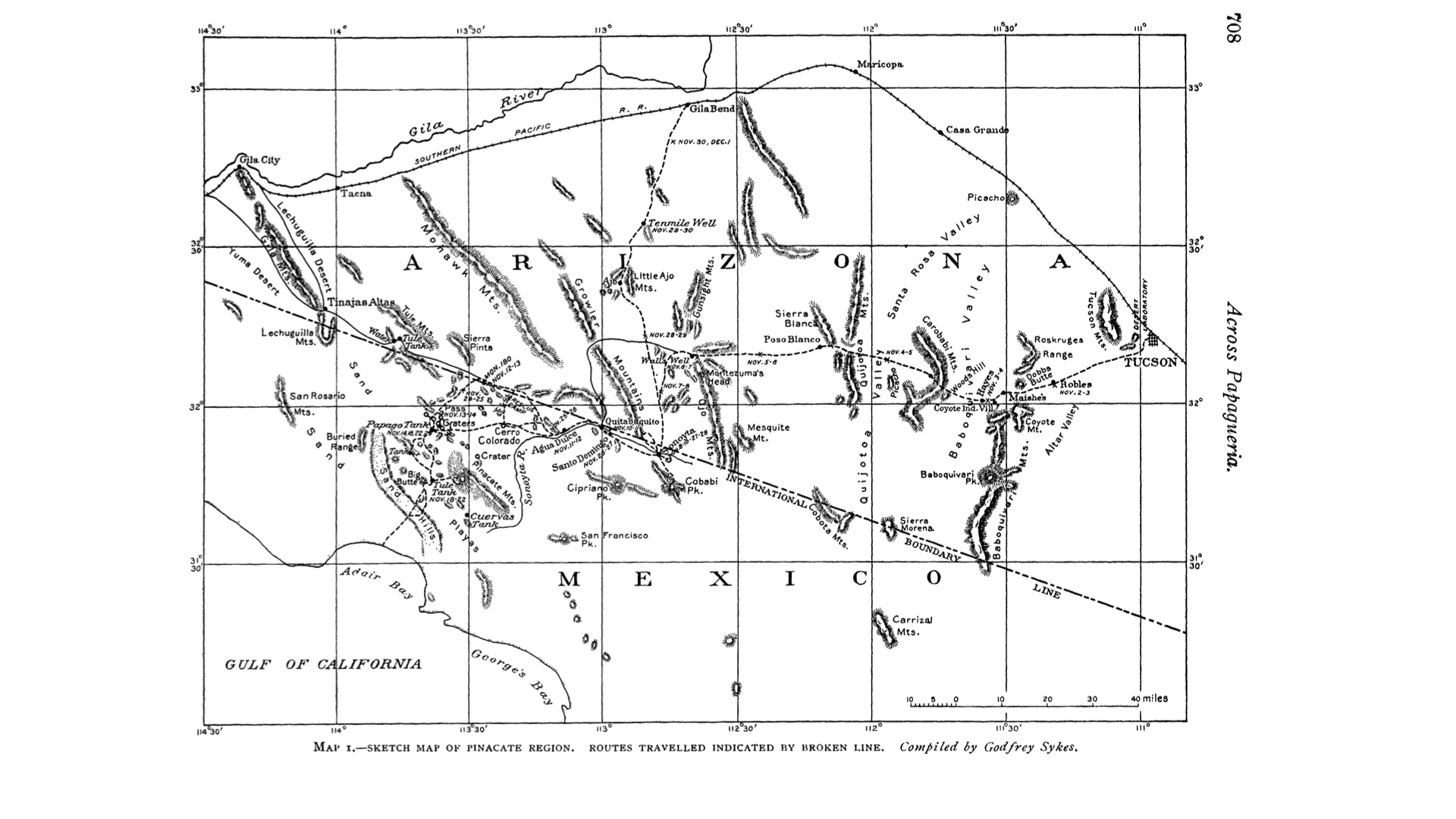
O’odham Land Called “Papaguería” by Spanish, Mexican, and U.S. American Sources. Map by Godfrey Sykes in D.T. MacDougal (1908), “Across Papaguería,” Bulletin of the American Geographical Society, 40(12): 705-725. 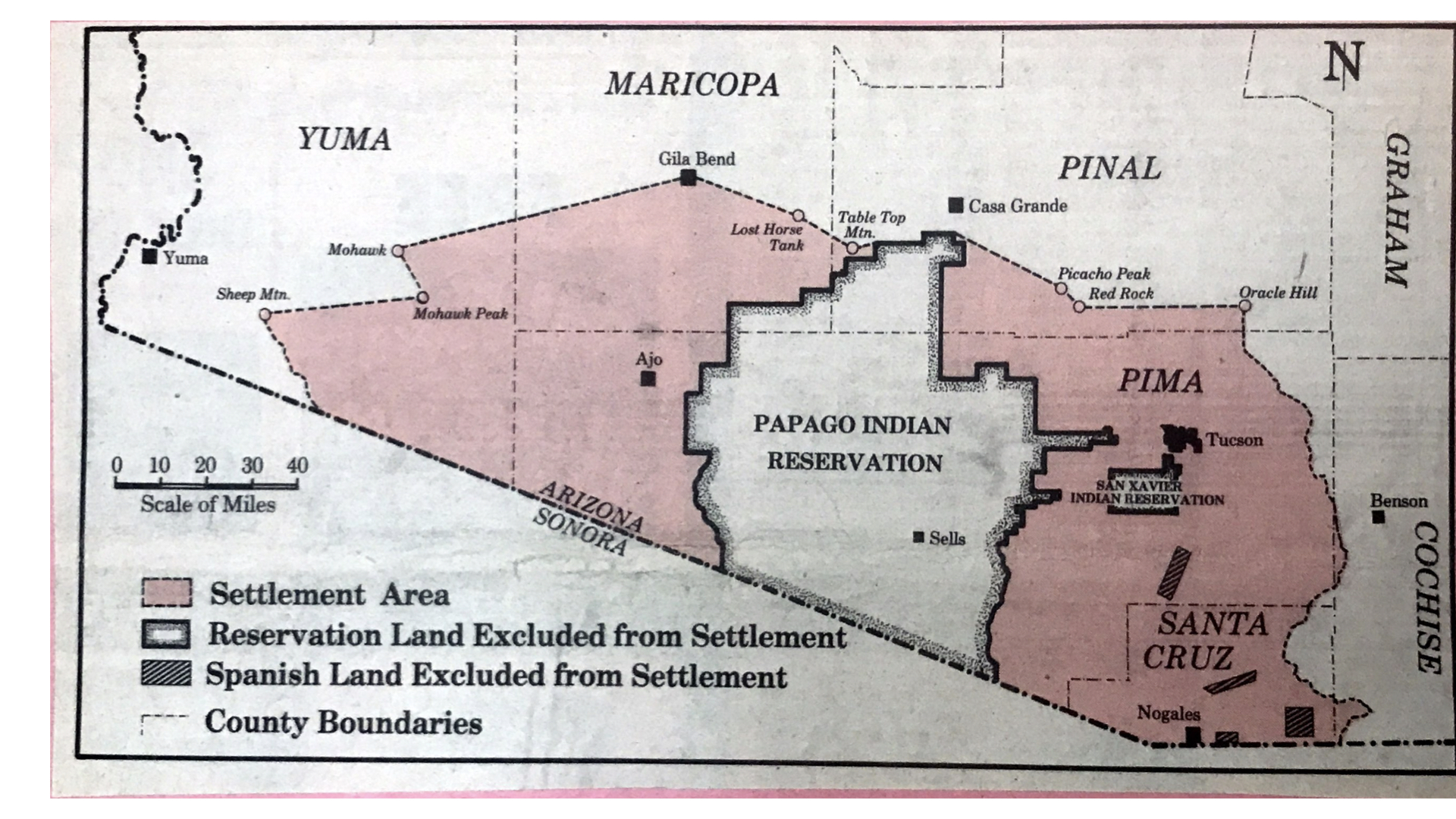
Indian Claims Commission Land Settlement Area for Tohono O’odham (Papago) Nation. In Edward Stiles (1976), “Papago Tribe…” Tucson Daily Citizen, 22 March. 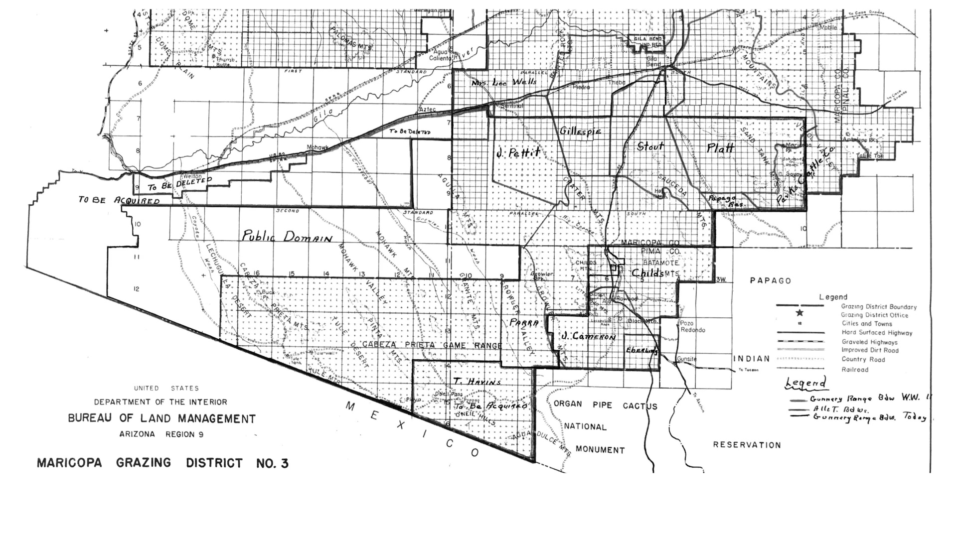
Family Grazing Allotments Affected by the Bombing Range and Cabeza Prieta Game Range, 1952. In Records of the Bureau of Land Management, National Archives and Records at Riverside, CA. Collection BLM Arizona, Phoenix Land Office, Grazier Region 9. Record 49, Box 1. 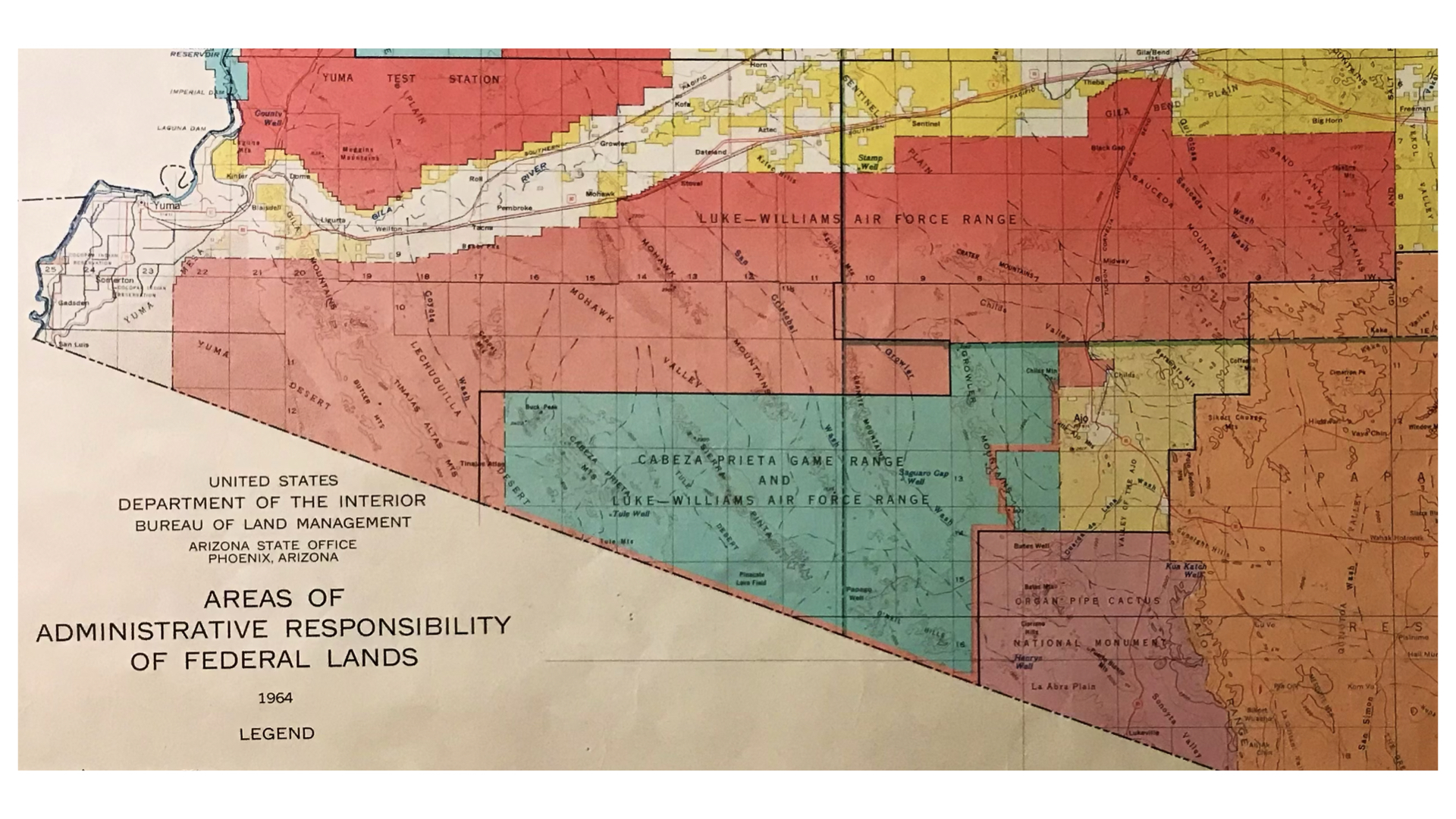
Land Management Areas of Southwestern Arizona, 1964. Showing “Cabeza Prieta Game Range and Luke-Williams Air Force Range.” 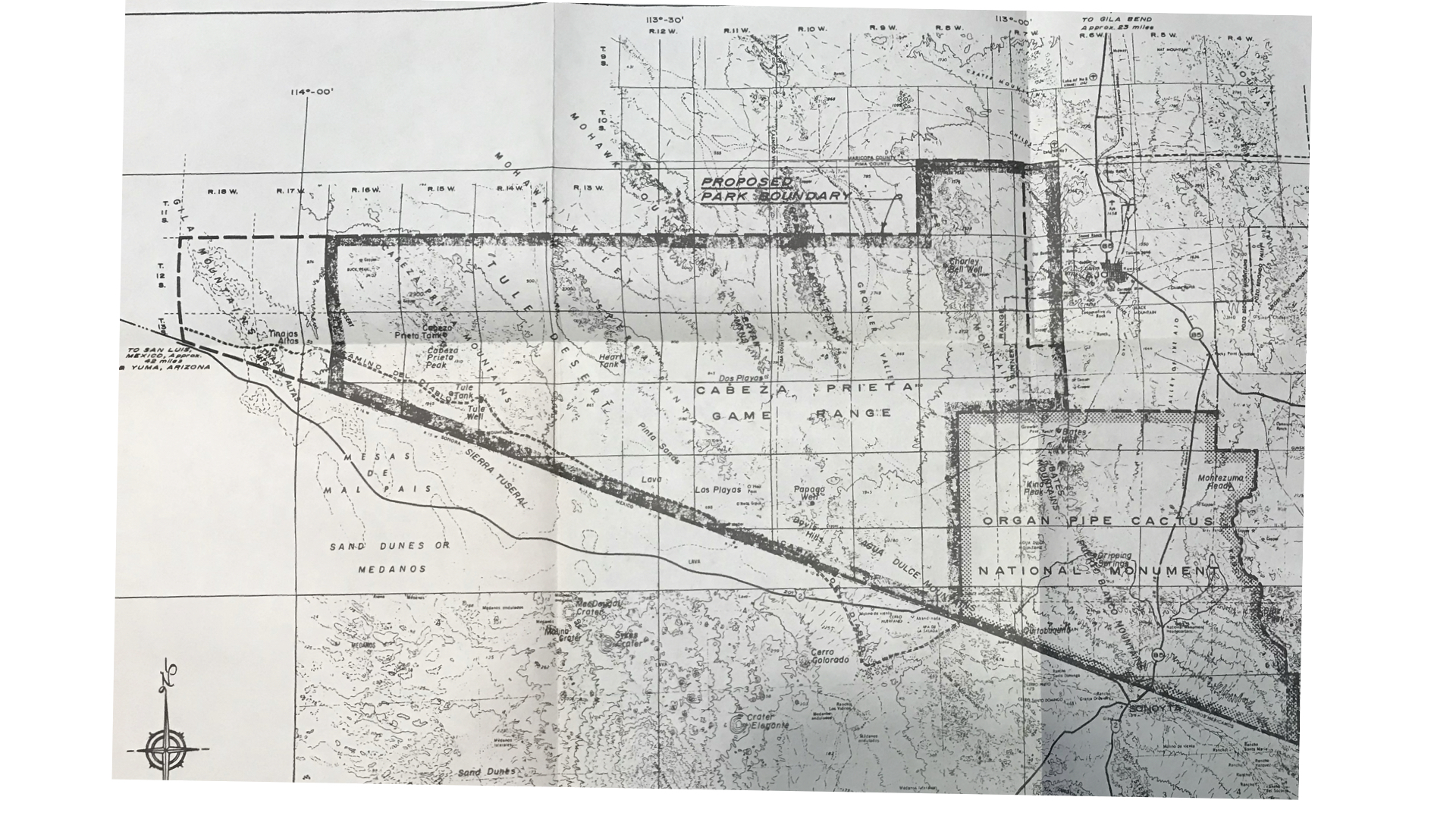
Boundaries proposed for a New Sonoran Desert National Park, 1965. Includes Organ Pipe Cactus NM, Cabeza Prieta GR, and Tinajas Altas portion of Bombing Range. In Sonoran Desert National Park: A Proposal, 1965 May. U.S Department of the Interior, National Park Service Southwest Region. 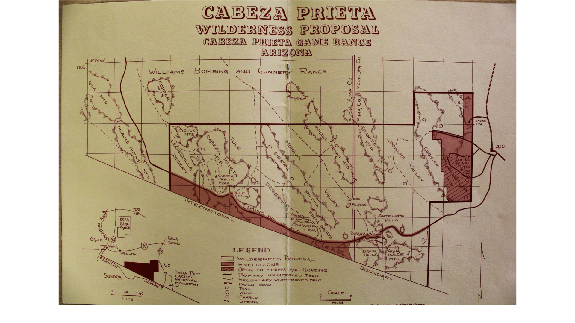
Wilderness Proposal for Cabeza Prieta Game Range, 1980. 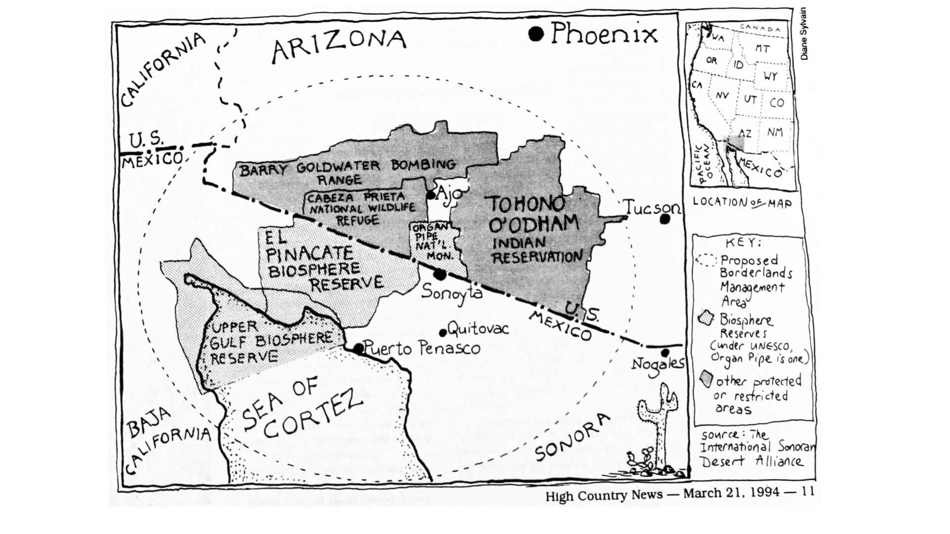
Proposed Borderlands Conservation Management Area, 1994. Map by Diane Sylvain in High Country News. 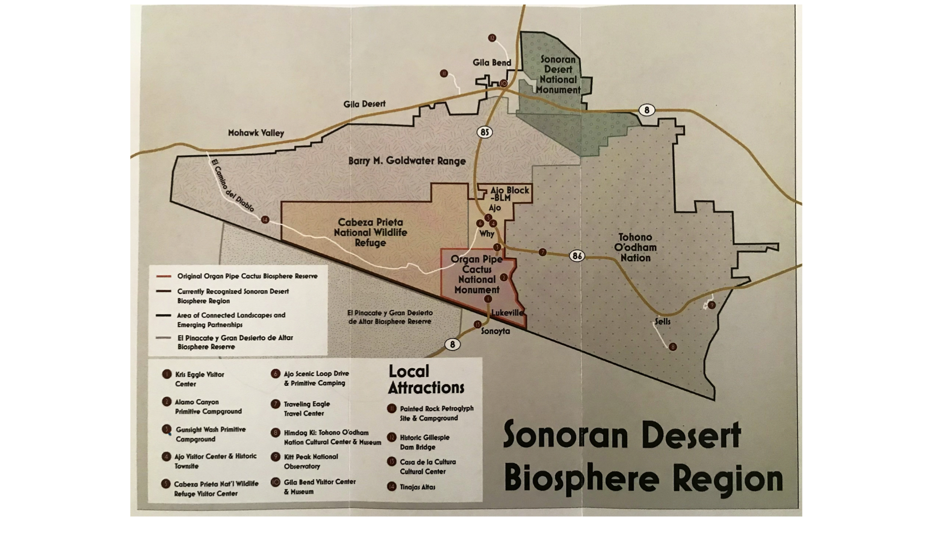
The Sonoran Desert Biosphere Reserve Economic Development Region, 2024. Map by International Sonoran Desert Alliance. See isdanet.org/biosphere-regions 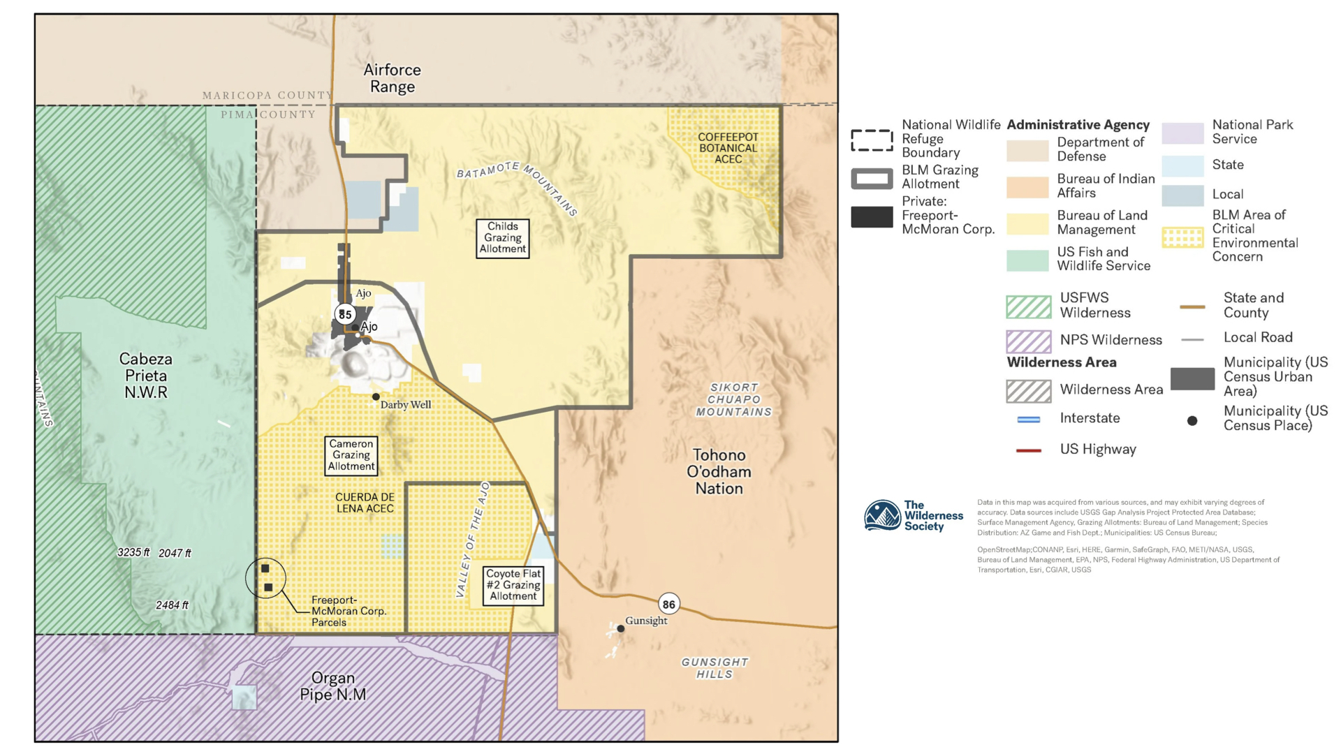
Bureau of Land Management (BLM) “Ajo Block” and Adjacent Areas, 2023. The future of the Ajo block of public lands is uncertain, with ongoing efforts to expand Cabeza Prieta National Wildlife Refuge, restore land to Hia C-ed O’odham stewardship, and expand mining. Map by The Wilderness Society. See isdanet.org/expansion. 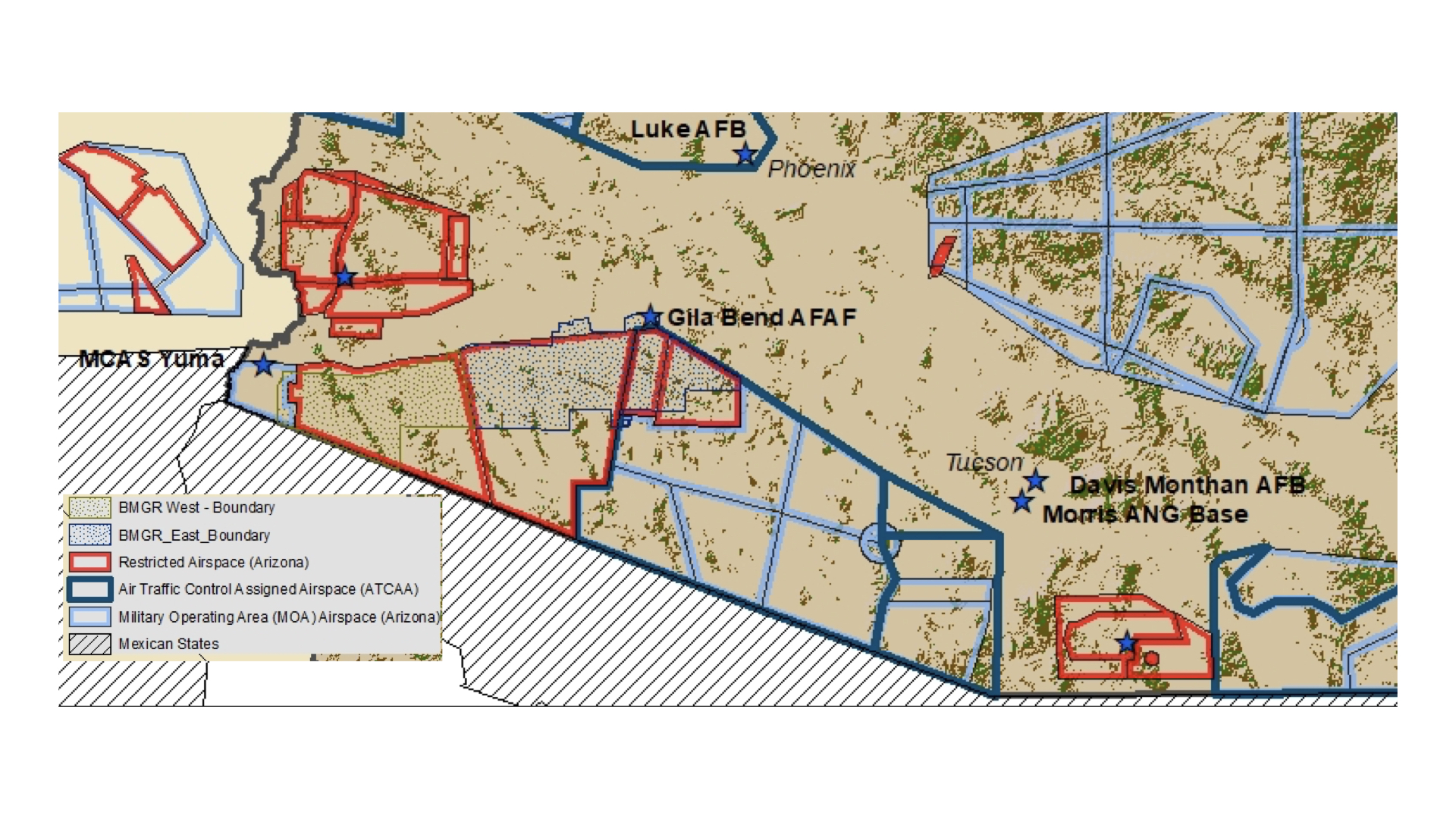
Military Airspace and Training Areas in Southern Arizona, 2024. Virtually all of the Arizona borderland is a military training area of some kind. In “Thunder Overhead: Understanding Jet Noise” (2024), Luke Air Force Base. 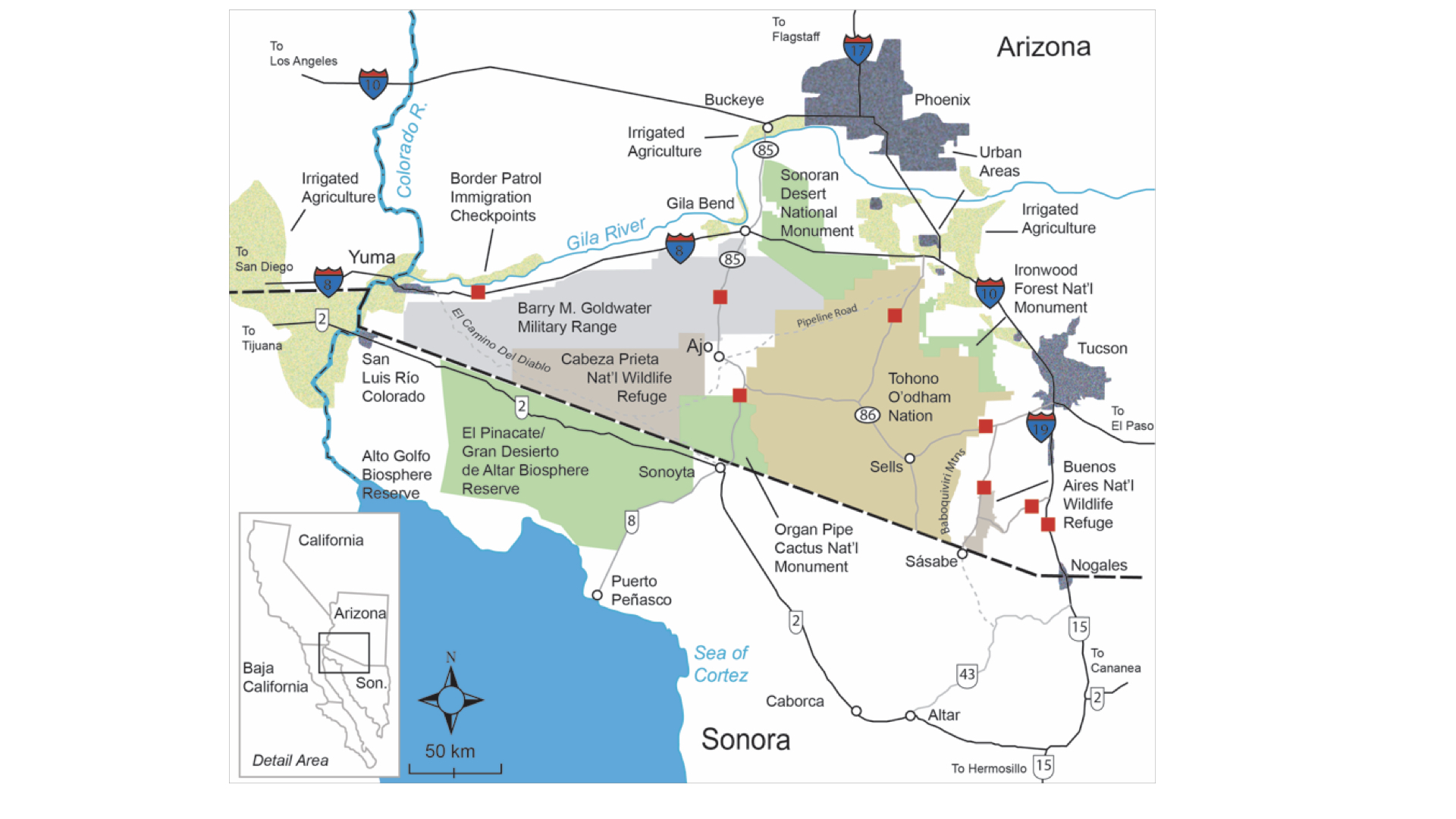
Border Patrol Highway Checkpoints and Land Management Areas, 2015. Most of these highway checkpoints became permanent installations in the first decade of the 21st century. Map by Scott Warren. 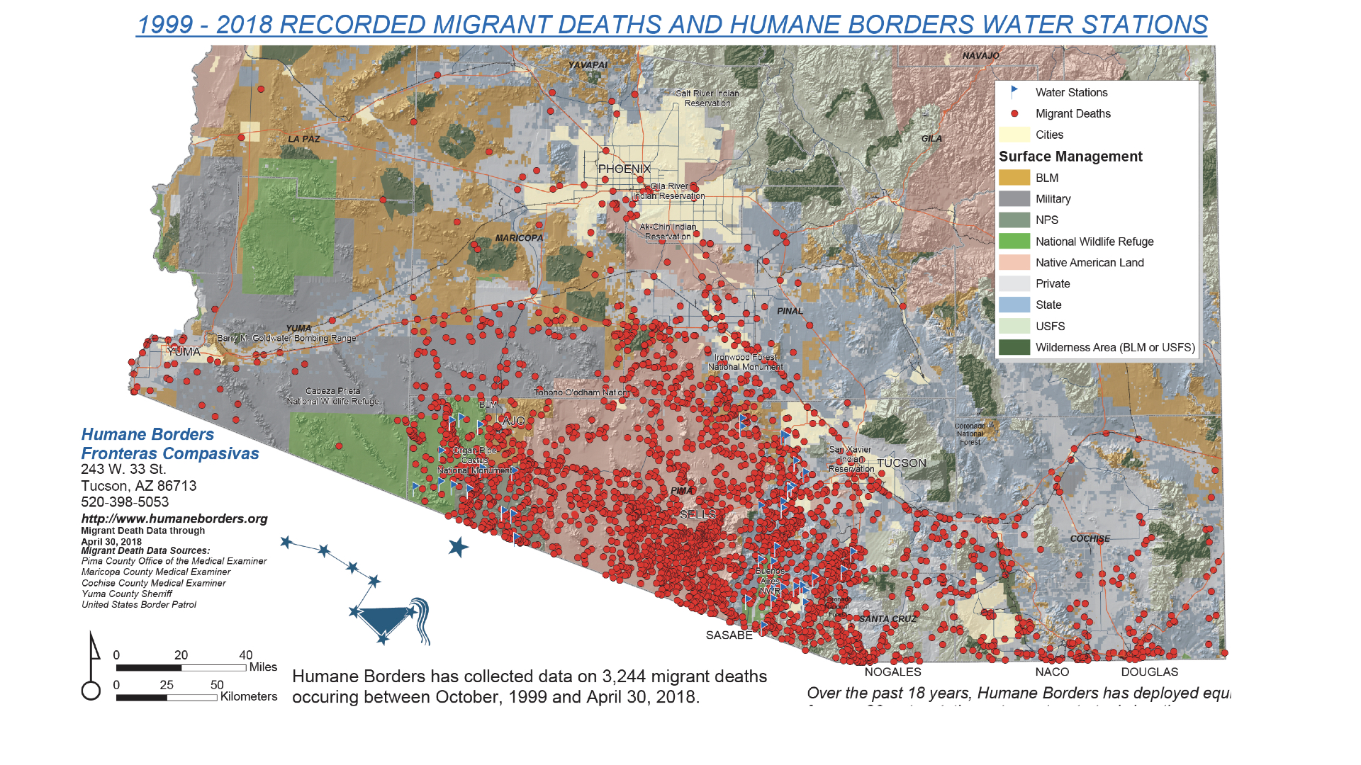
Recovered Human Remains in Southern Arizona, 1999-2018. The data in this map played a central role in the misdemeanor and felony border humanitarian aid trials in 2018-2019. Map by Humane Borders. 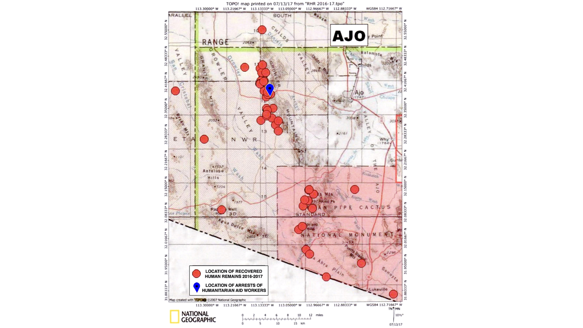
2016-2017 Recovered Human Remains on Organ Pipe Cactus NM and Cabeza Prieta NWR. Also showing location where volunteers were cited for leaving water in 2017. 
Portion of USGS Map, for Kirk Bryan’s “Routes to Desert Watering Places…,” 1922. Showing Old Ajo, Ajo (the new company town), Clarkston/Rowood and other important settlement sites at the beginning of large scale open pit copper mining at the New Cornelia Mine in the Ajo Mining District. 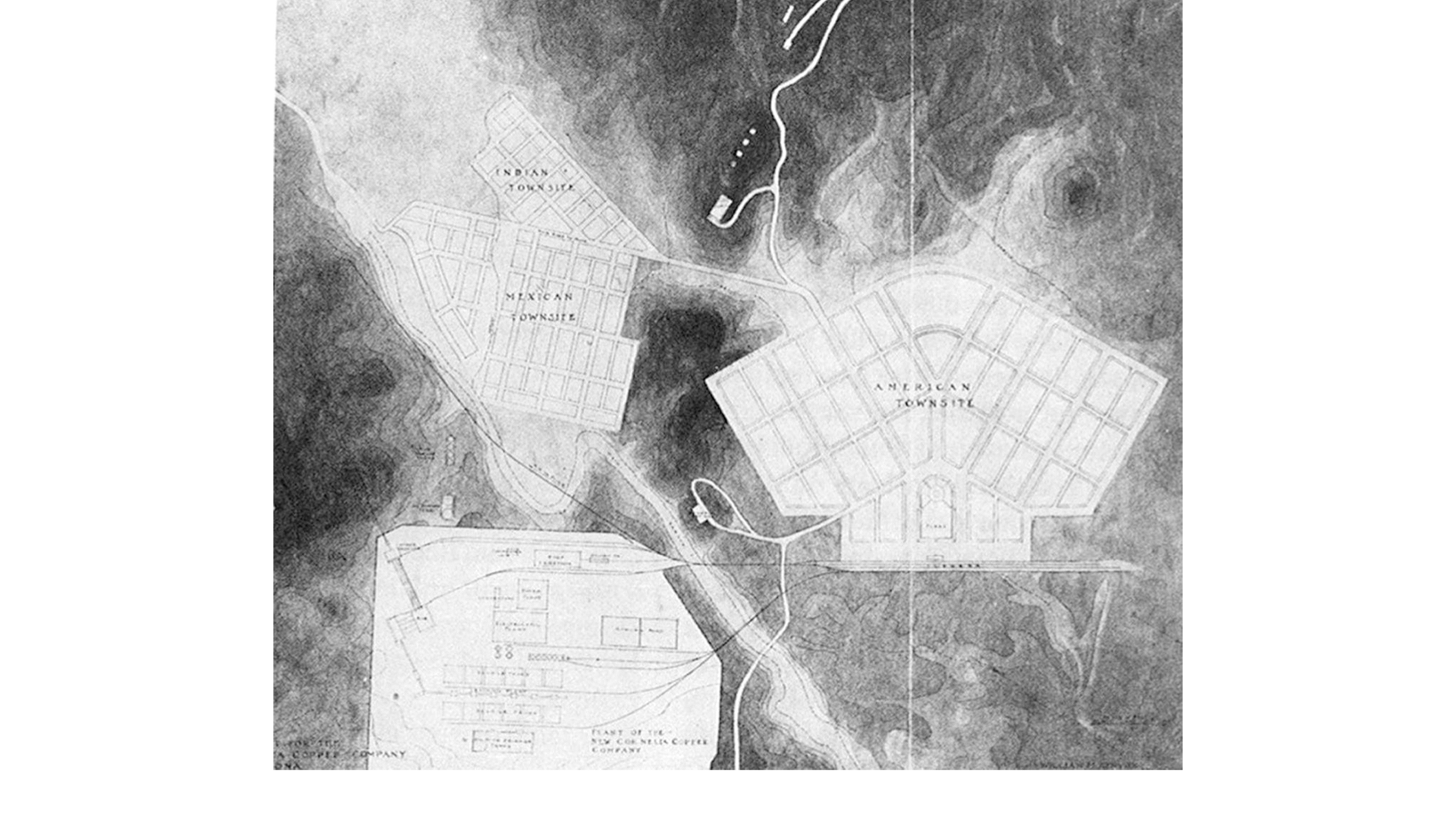
Plan for the New Company Town in the Ajo Mining District by Kenyon and Maine, 1910s. This “New Ajo” built by the mining company was divided into American Townsite, Mexican Townsite, and Indian Townsite. In David Gebhard (1986), “Ajo, Arizona’s Garden City,” Triglyph (4): 33-44. 
Plan for Clarkston, 1916 (in Sam Clark Papers, University of Arizona Special Collections). Layered on 2024 Google Earth image to show location of townsite (green lines are mining claim boundaries). Through the 1930s, Clarkston/Rowood served as an alternative to the Ajo company town where racial segregation was less strict. 
Portion of Ajo Quadrangle, 1932. Including Hia C-ed O’odham community sites at Chico Shunie Well, Darby Well, and Childs Ranch-Hotshot. Also included are communities at Clarkston/Rowood, Mexican Town, Ajo (New Ajo), and Gibson. Childs Ranch-Ten Mile not shown. By this time Old Ajo had been completely subsumed by the expanding open pit copper mine. 
Mexican Townsite in the New Ajo Company Town, 1918. From Arizona State Library Archives, Phoenix. 
American Townsite in the New Ajo Company Town, 1927. Note that the company didn’t build housing in the so-called Indian Townsite until about 1930. From Arizona State Library Archives, Phoenix. 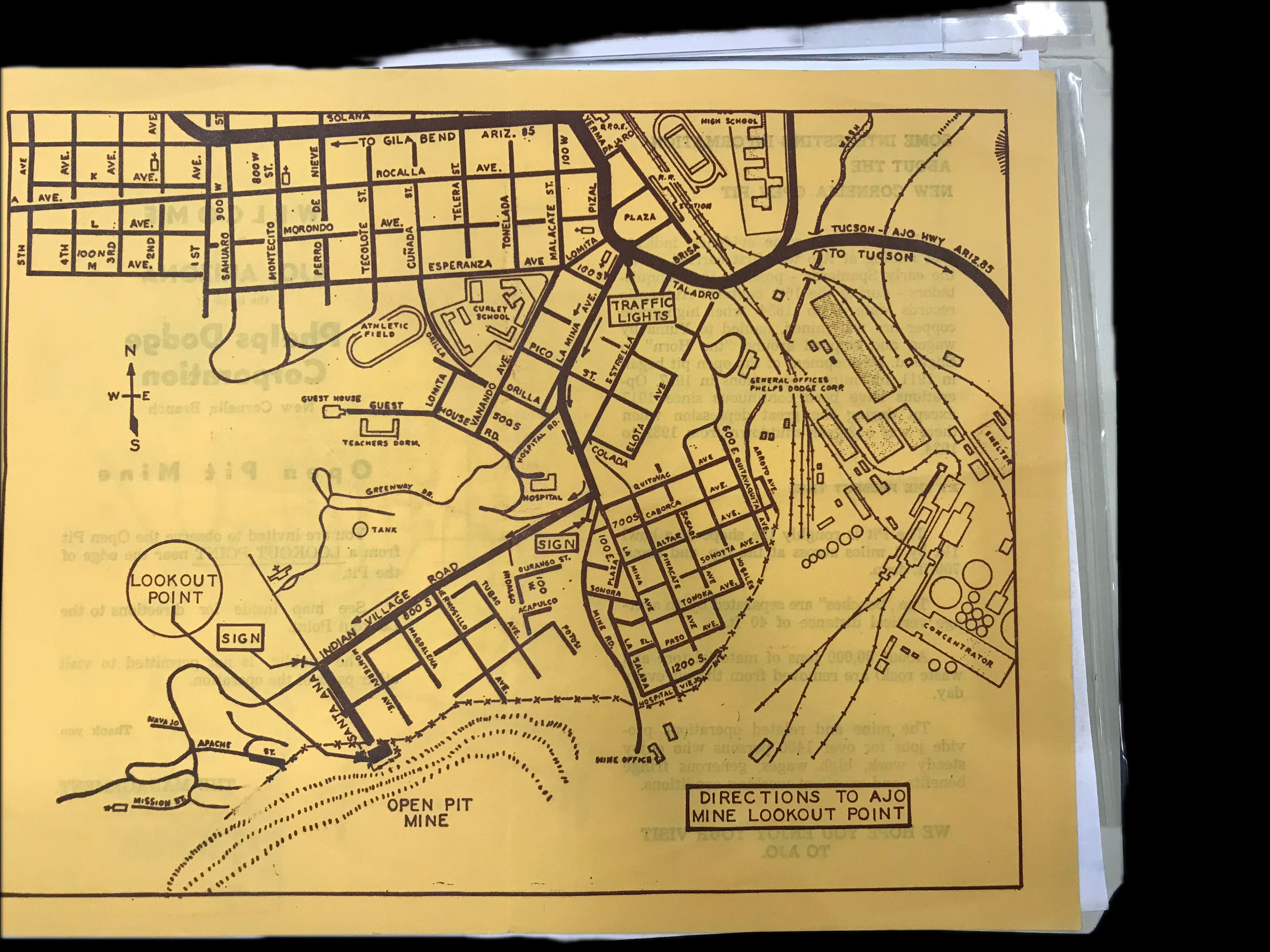
Directions to Ajo Mine Overlook, c. 1960s. Passing through the districts formerly known as American Town, Mexican Town, Tortilla Flats/Clarkdale, and Indian Village. Phelps Dodge Promotional Material.
